Description and route map
Description and route map MEMORIAL KARLA RAISE description and route map The race takes place on closed roads II. class without the use of motor vehicles. Start at an altitude of 220 m, target altitude of 172 m total length of the track is 15 km. Digital maps, gps navigation for PDA, PC Copyright PLANstudio sro 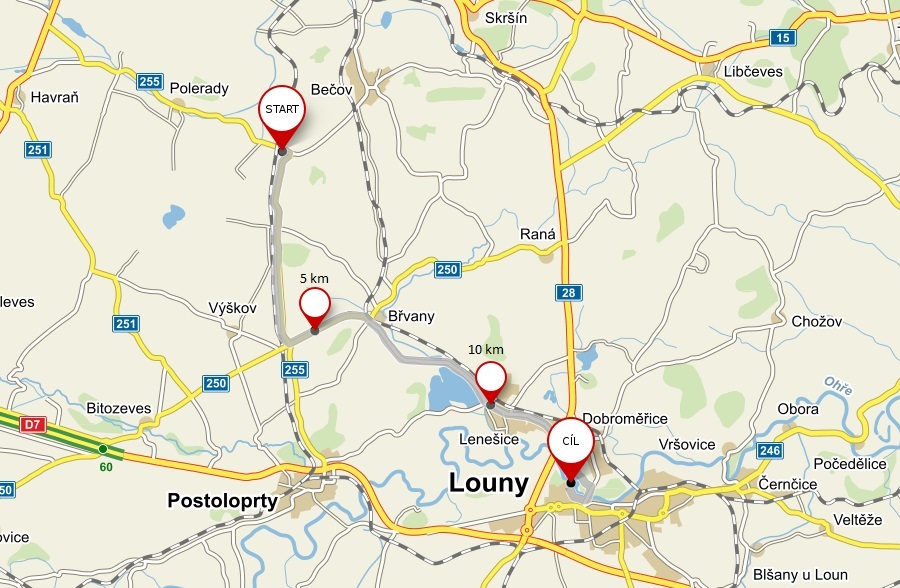
Language